View CartMy Account / Order StatusHelp

Join our email list for new product announcements!

Privacy Policy


(Your shopping cart is empty)
You are here: Home > City/County Street Maps > El Paso
Click the product image or name for MORE INFO.
Sort By:
Page of 1
El Paso Street Guide by Mapsco
List Price: $16.95
Our Price: $15.95
You save $1.00!

FREE SHIPPING* on all Mapsco street guides!
This 11th Edition El Paso Street Guide and Directory from Mapsco covers all of El Paso County, Plus over 14 other municipalities. Includes all of El Paso County plus Chaparral, Anthony and Santa Teresa New Mexico. Other cities include Anthony, Vinton, Conutillo, Sparks, El Paso Hills, Horizon City, Clint, Socorro, San Elizario, Fabens, and Tornillo.
If you need the big picture, see Mapsco's excellent El Paso wall maps!
Additional quantity discounts available!
El Paso Street Guide by Rand McNally
List Price: $16.95
Our Price: $15.35
You save $1.60!

Rand McNally's 5th Edition Street Guide for the El Paso area is all you need to get from point A to point B. Our easy-to-use, comprehensive guide features clear, detailed street-level maps, and the bold design compliments the enhanced cartography within. The convenient lay-flat spiral binding allows for easy reference on the road.
Additional quantity discounts available!
El Paso by Rand McNally
Our Price: $4.95

Rand McNally's folded map for El Paso shows all Interstate, U.S., state, and county highways, along with clearly indicated parks, points of interest, airports, county boundaries, and streets. The easy-to-use legend and detailed index make for quick and easy location of destinations.
Communities covered: Fort Bliss and Socorro.
Insets include: El Paso & Vicinity, El Paso y Los Alrededores, Biggs Army Air Base, and Base Aerea del Ejercito Biggs.
This map ships USPS First Class for $3.95! (other shipping choices also available)
El Paso Flip Map by Universal Map
Our Price: $7.95

This Flip Map of El Paso by Universal Map is laminated and includes Ciudad Juarez, Mexico, Hacienda Heights, Lizard, Loma Terrace, Sunland Park, Fort Bliss Military Installation, Biggs Army Airfield, and more. Features travel routes, railroads, boundaries, cemeteries, indexing, schools/colleges/universities, fire stations, golf, government buildings, hospitals, libraries, parks, post offices, shopping centers, zip codes/boundaries, and places of interest.
NOTE: Universal's Flip Maps, while handy and very durable, only cover the central part of larger cities If you need coverage of outlying areas, you should choose the standard folded map.
This map ships USPS First Class for $3.95! (other shipping choices also available)
El Paso by Universal Map
Our Price: $4.95

This El Paso street map by Universal Map includes Anthony, Buena Vista, Canutillo, Ciudad Juarez (Mexico), Clint, Fort Bliss Military Reservation, Horizon City, La Union, Nuway, San Elizario, Socorro, Sunland Park (New Mexico), Vinton, Westway, and neighboring communities. It features an inset map of Downtown El Paso, color-coded travel routes, boundaries, railroads, zip codes/boundaries, parks, golf courses, cemeteries, points of interest, shopping centers, colleges/universities, hospitals, industrial parks, government buildings, police/fire stations, post offices, libraries, and airports.
This map ships USPS First Class for $3.95! (other shipping choices also available)
El Paso by Five Star Maps
Our Price: $4.95

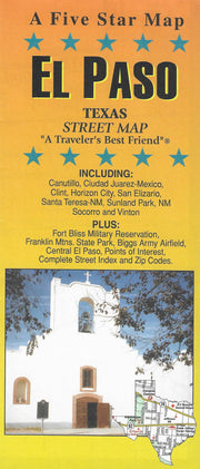
This folding street map of El Paso from Five Star Maps also covers Biggs Army Field, Canutillo, Cuidad Juarez, Clint, Fort Bliss, Franklin Mtn. State Park, Horizon City, San Elizario, Santa Teresa and Socorro and features areas of interest, golf courses, parks, schools, zip codes and an inset map of downtown El Paso.
This map ships USPS First Class for $3.95! (other shipping choices also available)
El Paso by Mapsco
Our Price: $5.95

This full-color StreetMap of El Paso, Texas includes Anthony, Buena Vista, Canutillo, Ciudad Juarez (Mexico), Clint, Fort Bliss Military Reservation, Horizon City, La Union, Nuway, San Elizario, Socorro, Sunland Park (New Mexico), Vinton, Westway, and neighboring communities. Featured is an inset map of Downtown El Paso. Other features include color coded travel routes, boundaries, railroads, ZIP codes and ZIP code boundaries, parks, golf courses, cemeteries, points of interest, shopping centers, colleges and universities, hospitals, industrial parks, government buildings, police and fire stations, post offices, libraries, and airports.
This map ships USPS First Class for $3.95! (other shipping choices also available)
   
 
True North Publishing
PO Box 308
Bulverde, TX 78163
830-885-4668
 Contact Us
 Privacy Policy
 Send Us Feedback