View Cart
My Account / Order Status
Help
Search
Shop By Category
Texas Road Maps
Texas Wall Maps
Texas Road Atlases
City/County Street Maps
City/County Map Books
City/County Wall Maps
Lake & Coastal Maps
Topographic & Earth Sciences Maps
Historical Maps
Historical County Maps
Historical Topo Maps
Birding & Wildlife Maps
Decorative Maps
"From Space" Posters
Educational Maps & Atlases
Odds & Ends
Free PDF Maps
Gift Certificates
Major Publishers
Key Maps
Mapsco
Rand McNally
Texmaps
Universal Map
Join our email list for new product announcements!
Privacy Policy
(Your shopping cart is empty)
You are here:
Home
>
City/County Street Maps
>
Laredo
Click the product image or name for
MORE INFO
.
Sort By:
Price: Low to High
Price: High to Low
Most Popular
Title
Manufacturer
Newest
Oldest
Availability
10 per page
20 per page
40 per page
60 per page
100 per page
Page
of 1
Laredo Area Atlas, 6th edition by Texmaps
List Price: $19.95
Our Price:
$18.45
You save $1.50!
New for 2011! 
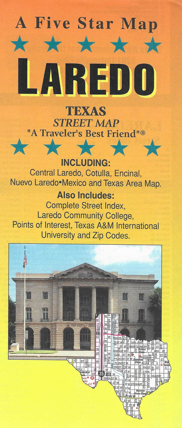
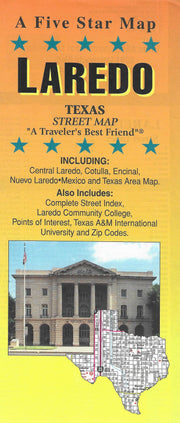
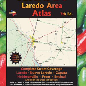
Detailed street maps of Laredo Texas and Nuevo Laredo Tamaulipas. Also covers Zapata, Freer, Hebbronville, Encinal, Benavides, etc. More than 100 pages of maps, covering over 9,000 square miles in nine counties and more than 20 communities in both Texas and Mexico. Includes all of Webb County, most of Duval, Zapata and Jim Hogg Counties and portions of Brooks, Dimmit, LaSalle, Maverick and McMullen Counties. Complete index of streets with zip codes.
Additional quantity discounts available!
Rio Grande Valley Cities & Towns Atlas by Mapsco
List Price: $8.95
Our Price:
$7.75
You save $1.20!
FREE SHIPPING* on all Mapsco street guides!
This Rio Grande Valley Cities & Towns Atlas by Mapsco includes: Alamo, Brownsville, Del Rio, Eagle Pass, Edinburg, Harlingen, Laredo, McAllen, Mission, Pharr and San Juan, San Benito, South Padre Island & Weslaco. PLEASE NOTE: This atlas basically covers just the incorporated areas and does not have extensive coverage in rural areas.
Additional quantity discounts available!
Laredo/Nuevo Laredo by Rand McNally
Our Price:
$5.95
Rand McNally's folded folded map of Laredo, McAllen and Brownsville shows all Interstate, U.S., state, and county highways, along with clearly indicated parks, points of interest, airports, county boundaries, and streets.
Communities covered: Brownsville, Combes, Edinburg, Harlingen, Laredo, McAllen, Mission, Palm Valley, Pharr, Primera, San Benito and San Juan.
This map ships USPS First Class for $3.95! (other shipping choices also available)
Laredo/Nuevo Laredo by Universal Map
Our Price:
$4.95
This Laredo and Nuevo Laredo street map by Universal Map includes a Laredo Community College campus map, a Texas A & M International University campus map, and a Webb County highway map. Provides travel routes, railroads, schools, parks, golf courses, cemeteries, lakes/rivers, hospitals, airports, and points of interest.
This map ships USPS First Class for $3.95! (other shipping choices also available)
Laredo by Five Star Maps
Our Price:
$3.95
This folding street map of Laredo from Five Star Maps also covers Cotulla, Encinal, and Nuevo Laredo and features areas of interest, golf courses, parks, schools, zip codes and inset maps of central Laredo, Laredo Community College, Texas A&M International Univ. and South Texas.
This map ships USPS First Class for $3.95! (other shipping choices also available)
True North Publishing
PO Box 308
Bulverde, TX 78163
830-885-4668
Contact Us
Privacy Policy
Send Us Feedback
Company Info
|
Product Index
|
Category Index
|
Help
|
Terms of Use
Copyright © 2006 True North Publishing. All Rights Reserved.
Shopping Cart Software
by Volusion