Skip to content
Close menu
Texas Maps
Road Atlases
Wall Maps
Folded Maps
City Maps
Texas City Wall Maps
Street Guides
Folded Maps
Historical Maps
Texas
Topographic
County
War
Topographic Maps
Any Current US Topographic Map
Current Texas Topographic Maps
Historical Texas Topographic Maps
Classroom Maps
Earth Sciences
Educational
Historical
Outdoor Maps
Fishing Maps
Birding Maps
Current Topo Maps
Decorative Maps
Historical
Reference
Everything Else
Other State
Other State Historical Maps
USA
USA Historical Maps
USA Road Atlases
USA Wall Maps
Country Maps
World
World Wall Maps
Globes
Custom
Custom Design Maps
Log in
Cart
Translation missing: en.cart.general.close
My Account
Login
Contact Us
View Cart
Log in
Search
Site navigation
Cart
Search
"Close (esc)"
Texas Maps
Road Atlases
Wall Maps
Folded Maps
City Maps
Texas City Wall Maps
Street Guides
Folded Maps
Historical Maps
Texas
Topographic
County
War
Topographic Maps
Any Current US Topographic Map
Current Texas Topographic Maps
Historical Texas Topographic Maps
Classroom Maps
Earth Sciences
Educational
Historical
Outdoor Maps
Fishing Maps
Birding Maps
Current Topo Maps
Decorative Maps
Historical
Reference
Everything Else
Other State
Other State Historical Maps
USA
USA Historical Maps
USA Road Atlases
USA Wall Maps
Country Maps
World
World Wall Maps
Globes
Custom
Custom Design Maps
Home
/
San Angelo
San Angelo
San Angelo
Click the product image or name for
MORE INFO
.
View all
City/ County Folded Maps
City/County Street Maps. City/County Street Maps: Big Spring
City/County Street Maps. City/County Street Maps: San Angelo
Quick view
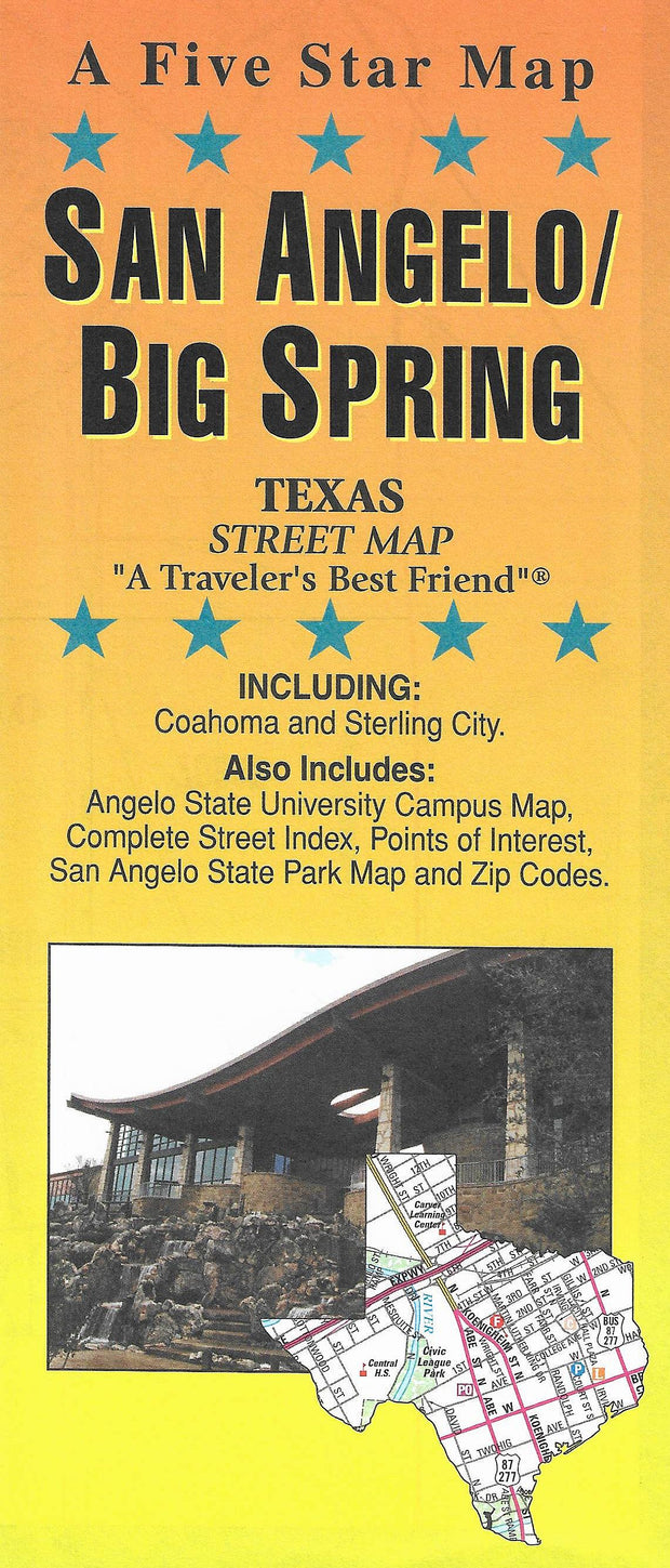
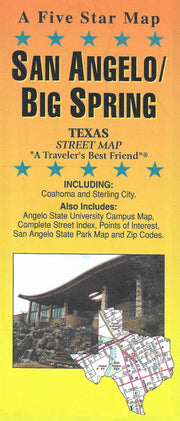
San Angelo/Big Spring by Five Star Maps
$14.95
San Angelo/Big Spring by Five Star Maps
FOLD133
Regular price
$14.95
-13 in stock
This folding street map of San Angelo/Big Spring from Five Star Maps also covers Coahoma and Sterling City and features areas of interest, golf courses, parks, schools, zip codes and inset maps of Angelo State Univ. and San Angelo State Park.
Reviews
Ask a question
Name
Email
Message
"Close (esc)"
"Close (esc)"