View Cart
My Account / Order Status
Help
Search
Shop By Category
Texas Road Maps
Texas Wall Maps
Texas Road Atlases
City/County Street Maps
City/County Map Books
City/County Wall Maps
Lake & Coastal Maps
Topographic & Earth Sciences Maps
Historical Maps
Historical County Maps
Historical Topo Maps
Birding & Wildlife Maps
Decorative Maps
"From Space" Posters
Educational Maps & Atlases
Odds & Ends
Free PDF Maps
Gift Certificates
Major Publishers
Key Maps
Mapsco
Rand McNally
Texmaps
Universal Map
Join our email list for new product announcements!
Privacy Policy
(Your shopping cart is empty)
You are here:
Home
>
City/County Street Maps
>
Golden Triangle
Click the product image or name for
MORE INFO
.
Sort By:
Price: Low to High
Price: High to Low
Most Popular
Title
Manufacturer
Newest
Oldest
Availability
10 per page
20 per page
40 per page
60 per page
100 per page
Page
of 1
Golden Triangle Atlas, 3rd edition by Texmaps
List Price: $24.95
Our Price:
$22.85
You save $2.10!
This fully indexed 3rd edition map book of the Golden Triangle area covers Beaumont, Port Arthur, Orange, Lumberton, Bridge City, Port Neches, Groves, Kountze, Silsbee, Vidor, Nederland, etc. It features more than 160 pages of maps, covering more than 3,400 square miles including all of Jefferson and Orange Counties, most of Hardin County and portions of Chambers, Jasper, Liberty and Newton Counties. Updated April 2009.
Additional quantity discounts available!
Beaumont & Port Arthur by Rand McNally
Our Price:
$4.95
Rand McNally's folded map featuring the streets of Beaumont & Port Arthur shows all Interstate, U.S., state, and county highways, along with clearly indicated parks, points of interest, airports, county boundaries, and streets.
Communities covered: Bridge City, Groves, Nederland, Pine Forest, Port Neches, and Vidor.
Insets include: Beaumont/Port Arthur & Vicinity and a Mileage & Driving Times Map.
This map ships USPS First Class for $3.95! (other shipping choices also available)
Beaumont/Port Arthur/Orange by Universal Map
Our Price:
$3.95
This Beaumont, Port Arthur and Orange street map by Universal Map includes Bridge City, Groves, Nederland, Pine Forest, Pinehurst, Port Neches, Rose City, Vidor, West Orange, and West Port Arthur. It features full street indexing, city and community index, places of interest index, Intercoastal Sabine Waterway River, Sabine Lake, J.D. Murphree Wildlife Management Area, Mobile Oil Refinery, Colliers Ferry Park, and the Big Thicket National Preserve, zip codes, parks, golf courses, cemeteries, shopping centers, colleges/universities, hospitals, schools, government facilities, fire/police stations, post offices, libraries, marinas, boat ramps, wineries, and airports.
This map ships USPS First Class for $3.95! (other shipping choices also available)
Beaumont/Port Arthur/Orange by Five Star Maps
Our Price:
$3.95
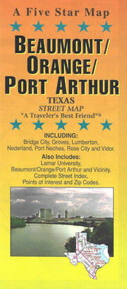
This folding street map of Beaumont/Port Arthur/Orange from Five Star Maps also covers Bridge City, Groves, Lumberton, Nederland, Port Neches, Rose City and Vidor and features areas of interest, golf courses, parks, schools, a complete street index and an inset map and building locator for Lamar University.
This map ships USPS First Class for $3.95! (other shipping choices also available)
True North Publishing
PO Box 308
Bulverde, TX 78163
830-885-4668
Contact Us
Privacy Policy
Send Us Feedback
Company Info
|
Product Index
|
Category Index
|
Help
|
Terms of Use
Copyright © 2006 True North Publishing. All Rights Reserved.
Shopping Cart Software
by Volusion