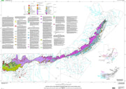
This attractive map/poster from the University of Texas Bureau of Economic Geology depicts surface geology for the state and includes a cross referenced stratigraphic column. This map comes rolled and shipped in a sturdy cardboard tube.
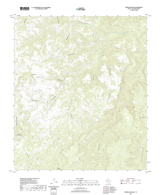
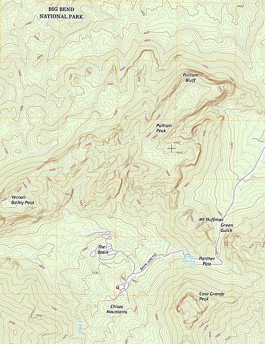
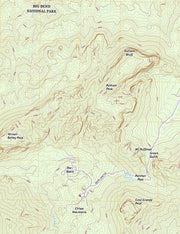
Any Current USGS TOPO Map - Select Your Quadrangle
TOPO100-01
Regular price
$24.95
-44 in stock
The current USGS topographic maps are scaled at 1:24,000 also know as the 7.5 series. Each map is referred to as a quadrangle. If you are not sure which quadrangle you need click the link at the bottom and follow these instructions:
Once you arrive at the USGS site type in the name of the location (city and state, mountain, national park, etc) you are searching in the search bar in the upper right corner.
Click on the round 24k red button and the list will display the names of the quadrangles associated with that area.
Use the zoom in and out button to see the quadrangle grids and names in an overlay of the map.
Once you have located the quadrangle you need simply type the name in the Quadrangle name field above , add it to your cart and we will get it printed up and shipped to you. It is that easy.
If you have any questions please feel free to give us a call anytime at 830-438-4080 and we will be happy to assist you with the process of identifying the map you need.
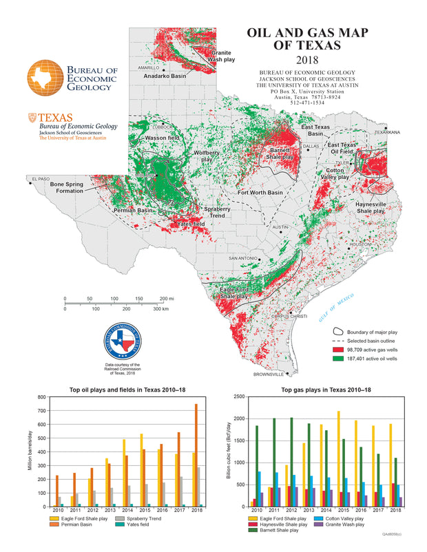
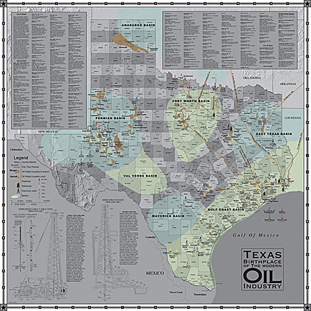
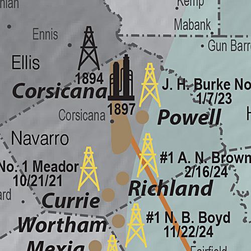
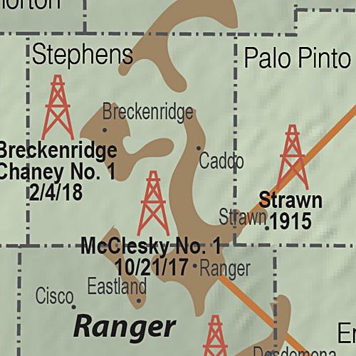
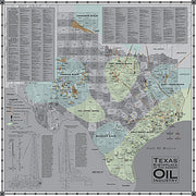
Oil and Gas Map of Texas
GEOL040
Regular price
$59.95
-20 in stock
Source: UT Bureau of Economic Geology
Includes Top Oil and Top Gas Plays
Data from the Railroad Commission of Texas
Texas has produced more oil and natural gas than any other state and to date remains the largest daily producer. Oil and natural gas are found in most parts of the state. No state or any other region worldwide has been as heavily explored or drilled for oil and natural gas as Texas. This beautiful laminated map/poster shows the oil and gas development in Texas in great detail and will be a compliment to any office or classroom. This map comes rolled and shipped in a sturdy cardboard tube.
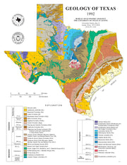
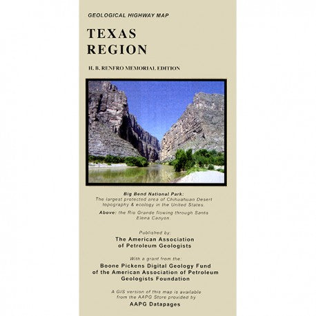
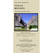
Geological Highway Map of Texas
GEOL010
Regular price
$29.95
-27 in stock
Learn more about the geological history of the rocks around you! This full-color map presents surface rock outcrop information - age, depositional environment, rock type, and names of formations - and includes major highways, towns, and landmarks. A stratigraphic column and mileage chart fill out the front of the map and various cross sections, inset maps showing gemstone locations, places of geological interest, fossil localities and much more, cover the back.
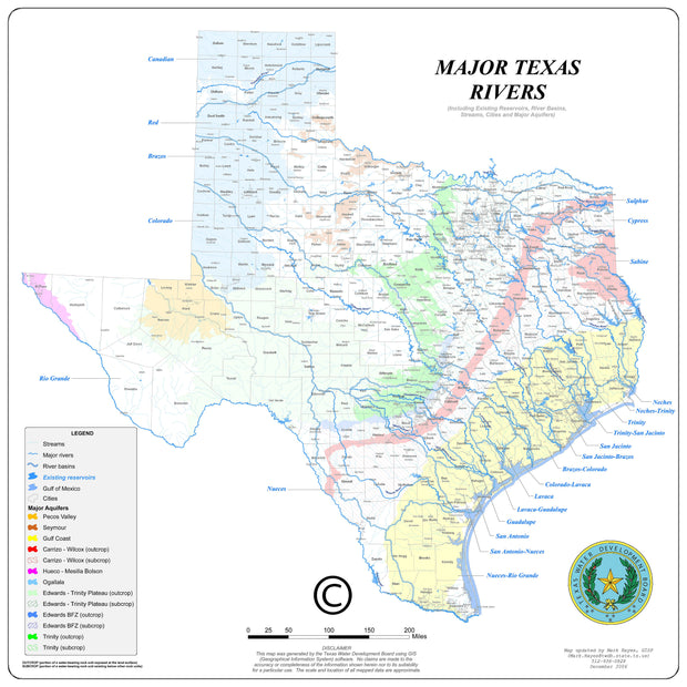
Major Texas Rivers Wall Map
1 review
TXWM013
Regular price
$59.95
-23 in stock
Paper or laminated
Source: Texas Water Development Board
Includes Rivers, Basins, Aquifers, Cities and Counties
Great Resource to Study Texas Hydrology
This wonderful laminated map from the Texas Water Development Board not only shows the major rivers of Texas and their basins, but also includes reserviors, major aquifers, major cities and counties . An excellent resource for anyone wanting to understand Texas hydrology.
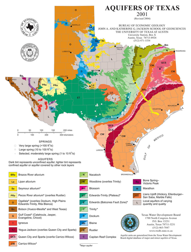
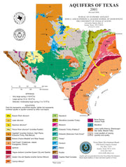
This beautiful laminated map/poster depicts the major and minor aquifers in Texas and describes their importance as part of the water cycle in supplying ground water for Texas. Information used in making this map was compiled primarily from maps and data at the Texas Water Development Board, the State agency charged with oversight of ground-water resources.
This map comes rolled and ships in a sturdy cardboard tube.
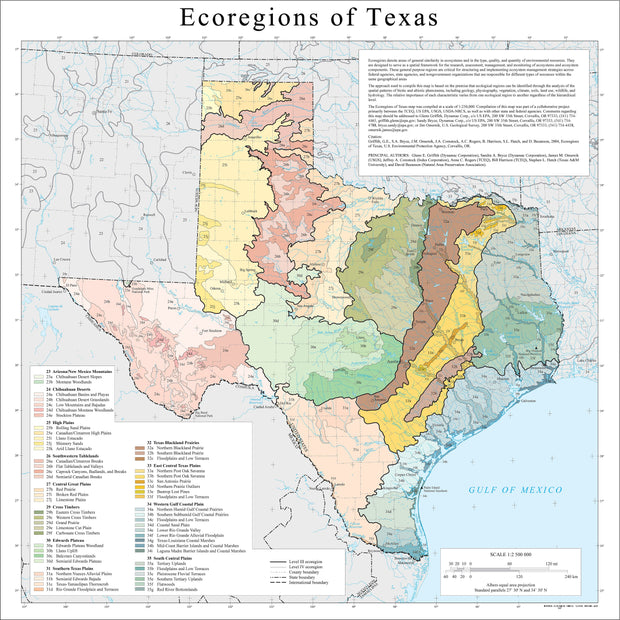
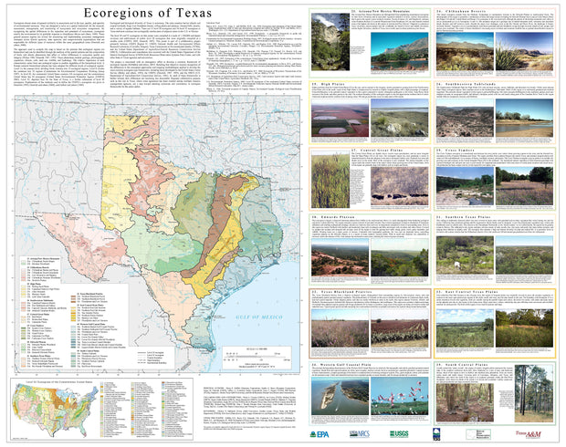
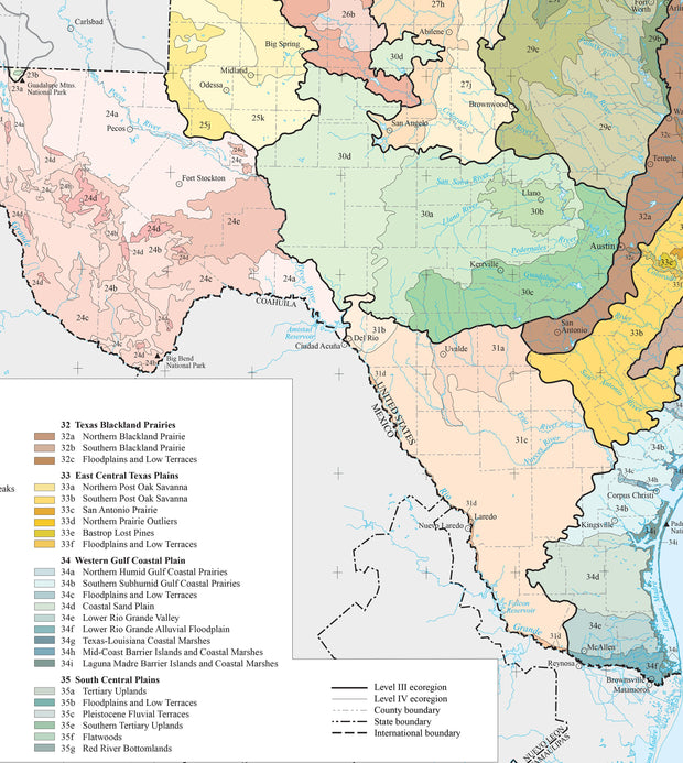
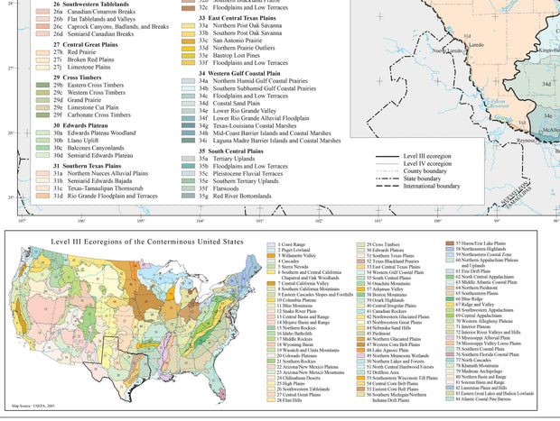
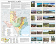
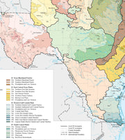
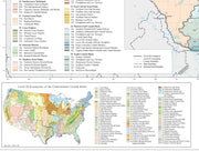
Ecoregions of Texas Map
1 review
ECOL003
Regular price
$59.95
-22 in stock
Source: Multiple State Agencies
Depicts the Biological Diversity of Texas
This large laminated map depicts the enormous ecological and biological diversity of Texas. The state contains barrier islands and coastal lowlands, large river floodplain forests, rolling plains and plateaus, forested hills, deserts, and a variety of aquatic habitats. There are 12 level III and 56 level IV ecoregions shown on this handsome map produced by the USEPA, the Texas Commission on Environmental Quality (TCEQ), the US Dept. of Agriculture-Natural Resources Conservation Service (NRCS), the USGS and other State of Texas agencies and universities. This map comes rolled and shipped in a sturdy cardboard tube.
Inset diagrams of rotary drilling rig and cable tools
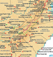
Most historians agree that Texas was the birthplace of the modern oil industry. When Anthony F. Lucas brought in the Spindletop gusher on 1/10/1901 using the rotary drilling method, it ushered in a new era of oil production. This map locates all of the significant oil discoveries in Texas from the beginning in 1866 through the 1950s. Early refineries and pipelines are also shown as well as diagrams of cable tool and rotary drilling rigs. This map comes rolled and shipped in a sturdy cardboard tube.
Interested in a framed version of this map? Click HERE
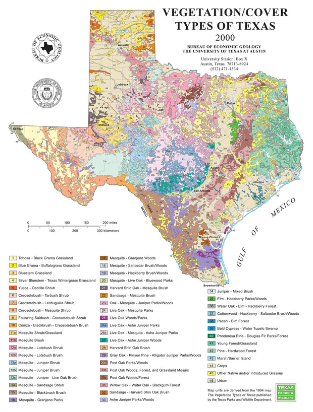
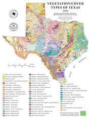
This beautiful map/poster shows vegetation in Texas divided into 53 cover types, including 47 plant associations of 2 or 3 characteristic species. The great diversity of plants in Texas and extensive modification of the landscape by land use are conveyed in the map explanation. This map comes rolled and shipped in a sturdy cardboard tube.
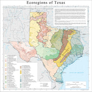
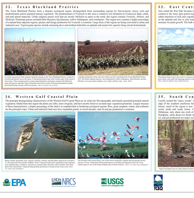
Using a large map, text and pictures, this laminated poster depicts the enormous ecological and biological diversity of Texas. The state contains barrier islands and coastal lowlands, large river floodplain forests, rolling plains and plateaus, forested hills, deserts, and a variety of aquatic habitats. There are 12 level III and 56 level IV ecoregions shown and described on this handsome poster produced by the USEPA, the Texas Commission on Environmental Quality (TCEQ), the US Dept. of Agriculture-Natural Resources Conservation Service (NRCS), the USGS and other State of Texas agencies and universities.
This map comes rolled and shipped in a sturdy cardboard tube.
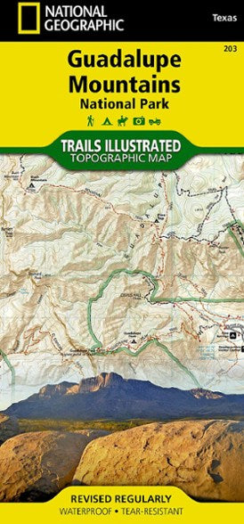
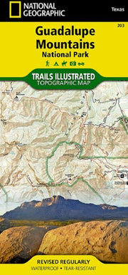
Trails Illustrated Guadalupe Mountains
TOPO060
Regular price
$19.95
-4 in stock
This Trails Illustrated topographic map is the most comprehensive and complete recreational map for Guadalupe Mountains National Park. The map includes valuable wilderness tips and Leave No Trace guidelines, along with updated trails, trailheads, points of interest, campgrounds, and much more. Printed on waterproof, tear-resistant material for extreme durability.
Edwards Aquifer Recharge Zone
GEOL030
Regular price
$69.95
0 in stock
This highly detailed map from the U.S. Geological Survey covers the Edwards Aquifer Recharge Zone from Austin to northwest of Uvalde and depicts the complicated geology of the area along with counties, cities and highways. Choose paper or laminated at checkout.
This map comes rolled and shipped in a sturdy cardboard tube.
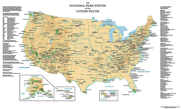
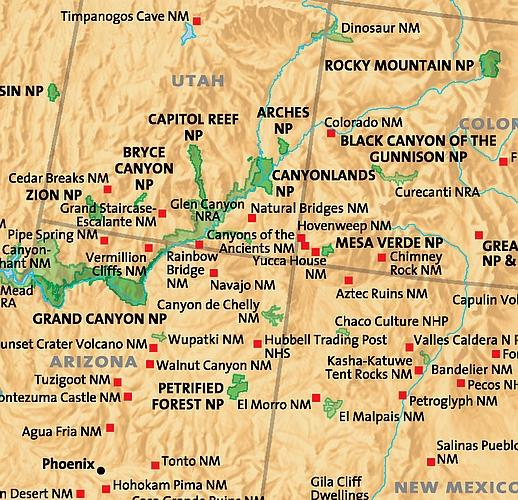
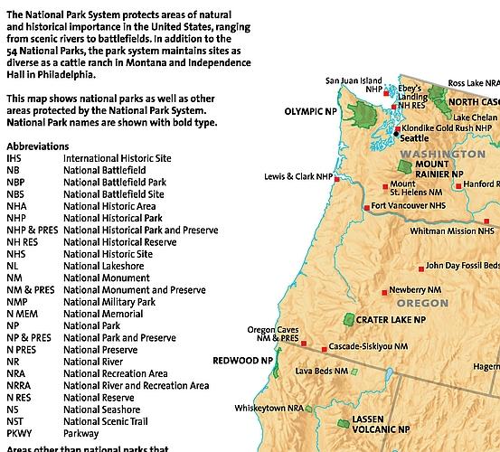
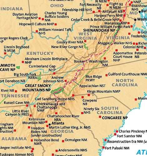
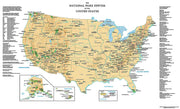
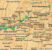
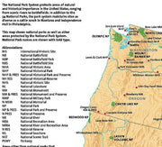
Perfect for home, business, or school, this US National Park Service wall map shows the location of all sites operated by the National Park system in the continental United States, Alaska, Hawaii, Puerto Rico and the U.S. Virgin Islands.
This map is printed on 36 lb premium coated paper or choose laminated at checkout.
This map comes rolled and ships in a sturdy cardboard tube.
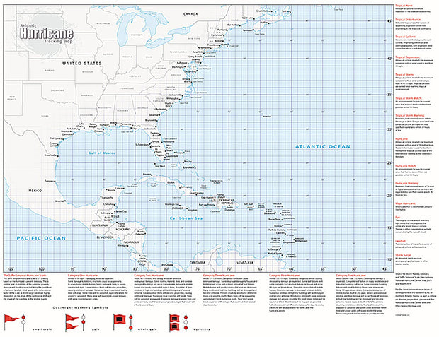
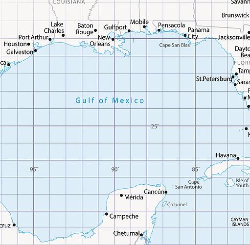
Atlantic Hurricane Tracking Map
ECOL006
Regular price
$69.95
-1 in stock
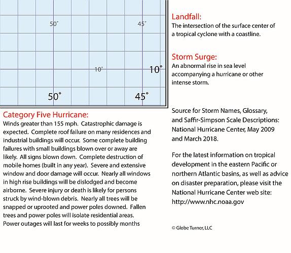
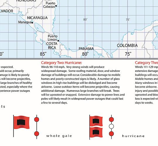
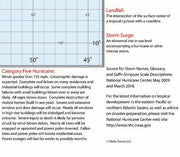
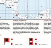
Glossary of tropical meteorology terms
Explanation of Saffir-Simpson Hurricane Wind Scale
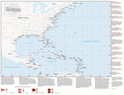
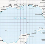
Longitude and Latitude Grid lines for easy tracking
Perfect for home, business, school, or governmental emergency planning agency, this map of the central and western North Atlantic Ocean, Caribbean Sea, and Gulf of Mexico is divided into one degree latitude and longitude grid lines to make the tracking of tropical systems easy. The map includes a glossary of tropical meteorology terms and an explanation of the Saffir-Simpson Hurricane Wind Scale. This map comes rolled and shipped in a sturdy cardboard tube.